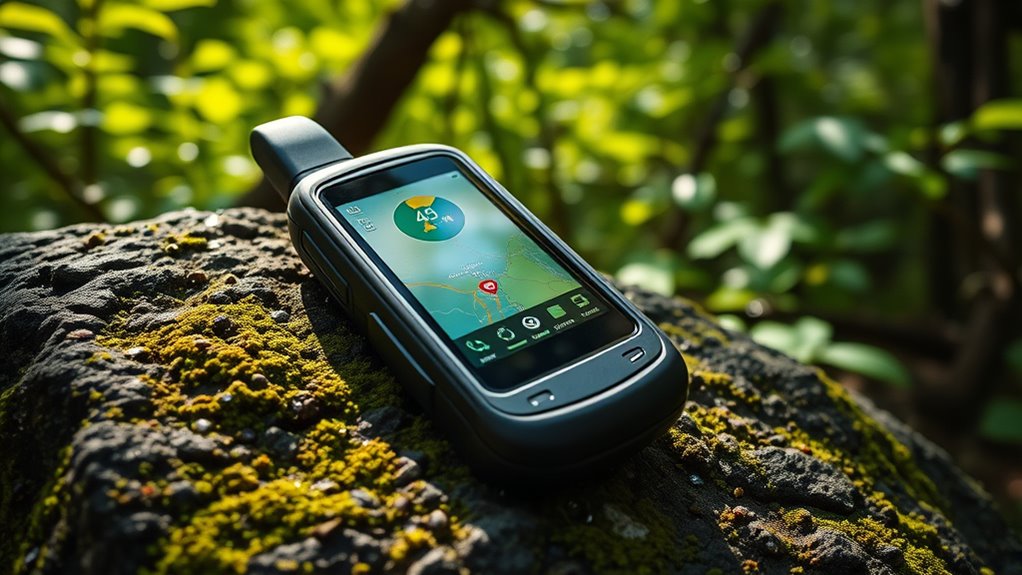

When choosing a handheld GPS unit, key factors include durability, accuracy, ease of use, and feature set. The Garmin eTrex 32x stands out as the best overall for its balance of ruggedness and detailed mapping, while the Garmin GPSMAP 79sc excels for marine navigation with water resistance and coastal charts. Budget-conscious buyers might prefer the Garmin eTrex 10 for its simplicity and affordability, but it sacrifices advanced features. The main tradeoffs involve weighing advanced mapping and ruggedness against simplicity and price. Continue reading for a detailed breakdown of these options and what fits your specific needs.
Prime for Young Adults — start your free trial
Fast free delivery, streaming and member deals for eligible 18–24 year olds.
Try it freeAs an affiliate, we earn on qualifying purchases.
Key Takeaways
- Top picks are distinguished by their durability, mapping detail, and water resistance.
- Higher-end models like the Garmin GPSMAP 79sc offer specialized features for boating and marine use.
- Budget options such as the Garmin eTrex 10 still provide essential navigation, but lack advanced features.
- Multi-band and multi-GNSS support are game-changers for accuracy in challenging environments.
- Choosing the right GPS depends heavily on intended use—hiking, boating, or general outdoor activities.
| Garmin eTrex SE GPS Handheld Navigator |  | Best Overall for Rugged Outdoor Use | Display: 2.2-inch high-resolution | Battery Life: up to 168 hours in standard mode | Batteries: 2 AA batteries (not included) | VIEW ON AMAZON | See Our Full Breakdown |
| Garmin GPS 73 |  | Best Marine Handheld for Sailing and Watercraft | Display Size: 2.6 inches | Battery Life: 18+ hours | Waypoints: 1,000 | VIEW ON AMAZON | See Our Full Breakdown |
| Garmin Montana 710 GPS Handheld Navigator |  | Best for Rugged, Advanced Outdoor Navigation | Display: 5-inch glove-friendly color touchscreen | Memory: 32 GB | Battery Life: Up to 24 hours | VIEW ON AMAZON | See Our Full Breakdown |
| Garmin GPSMAP 79sc Marine Handheld GPS with BlueChart g3 Coastal Charts |  | Best Marine-Exclusive with Charts and Floats | Screen Size: 6 inches | Additional Features: Floats, built-in compass | Battery Life: 20 hours | VIEW ON AMAZON | See Our Full Breakdown |
| Garmin eTrex 32x Rugged Handheld GPS Navigator |  | Best for Durable, Versatile Outdoor Use | Display: 2.2-inch sunlight-readable color display, 240 x 320 pixels | Preloaded Maps: Topo Active maps with routable roads and trails | Satellite Support: GPS and GLONASS | VIEW ON AMAZON | See Our Full Breakdown |
| Garmin GPSMAP 65 Handheld GPS with Multi-Band Technology and TopoActive Maps |  | Best Overall | Display: 2.6-inch color display | Satellite Support: Expanded GNSS and multi-band technology | Maps: TopoActive and federal public land map (U.S. only) | VIEW ON AMAZON | See Our Full Breakdown |
| Garmin GPSMAP 65s Handheld GPS with Altimeter and Compass, 2.6″ Color Display |  | Best for Advanced Navigation | Display: 2.6-inch color display | Satellite Support: Expanded GNSS and multi-band technology | Mapping: Routable TopoActive and federal public land maps | VIEW ON AMAZON | See Our Full Breakdown |
| Garmin eTrex 22x Handheld GPS Navigator |  | Best Rugged Value | Display: 2.2-inch sunlight-readable color display | Preloaded Maps: Topo Active with roads and trails | Satellite Support: GPS and GLONASS | VIEW ON AMAZON | See Our Full Breakdown |
| Handheld GPS for Hiking, Waterproof and Rugged with 3.2″ Sunlight Readable Screen, Multi-GNSS Support, and USA Topo Maps |  | Best for Extended Outdoor Use | Screen Size: 3.2 inches | Water Resistance: IP66 | Battery Life: Up to 36 hours | VIEW ON AMAZON | See Our Full Breakdown |
| Garmin eTrex 10 Worldwide Handheld GPS Navigator |  | Best Budget Rugged Choice | Display: 2.2-inch monochrome | Waterproof: IPX7 | Power: 2 AA batteries, up to 20 hours | VIEW ON AMAZON | See Our Full Breakdown |
| handheld gps unit | Display | Battery Life | Water Resistance |
|---|---|---|---|
| Garmin eTrex SE GPS Handheld N | 2.2-inch high-resolution | up to 168 hours in standard mode | IPX7 |
| Garmin GPS 73 | — | 18+ hours | Yes |
| Garmin Montana 710 GPS Handhel | 5-inch glove-friendly color touchscreen | Up to 24 hours | IPX7 |
| Garmin GPSMAP 79sc Marine Hand | — | 20 hours | Water-resistant and floats |
| Garmin eTrex 32x Rugged Handhe | 2.2-inch sunlight-readable color display, 240 x 320 pixels | Up to 25 hours | — |
| Garmin GPSMAP 65 Handheld GPS | 2.6-inch color display | — | — |
| Garmin GPSMAP 65s Handheld GPS | 2.6-inch color display | — | — |
| Garmin eTrex 22x Handheld GPS | 2.2-inch sunlight-readable color display | Up to 25 hours | — |
| Handheld GPS for Hiking | — | Up to 36 hours | IP66 |
| Garmin eTrex 10 Worldwide Hand | 2.2-inch monochrome | — | — |
More Details on Our Top Picks
Garmin eTrex SE GPS Handheld Navigator
This device stands out for its rugged build and multi-GNSS support, making it a reliable choice for challenging outdoor environments. Compared with the Garmin Montana 710, it offers a more compact form factor but sacrifices the high-resolution display and extensive mapping options. Its long battery life, capable of lasting up to 168 hours in standard mode, is ideal for multi-day adventures. However, it relies on 2 AA batteries, which are not included, and its small display may be a hurdle for some users seeking quick readability. While it excels in durability and basic navigation, it lacks a rechargeable battery and a larger screen. This pick is best for hikers, hunters, and adventurers who prioritize ruggedness and extended battery life over display size or built-in maps.
Pros:- Long battery life suitable for extended trips
- Multi-GNSS support ensures reliable navigation in tough environments
- Water-resistant IPX7 rating for all-weather use
- Wireless connectivity for easy updates and geocaching
Cons:- Requires 2 AA batteries (not included), which can be inconvenient
- Small display may be difficult to read for some users
- No built-in rechargeable battery limits convenience
Best for: Serious outdoor enthusiasts needing durable navigation in remote, weather-exposed conditions
Not ideal for: Casual users or those preferring a larger, rechargeable screen with detailed maps
- Display:2.2-inch high-resolution
- Battery Life:up to 168 hours in standard mode
- Batteries:2 AA batteries (not included)
- Water Resistance:IPX7
- Connectivity:Wireless with Garmin Explore app
- Support:GPS, GLONASS, Galileo, BeiDou, QZSS
Our verdict“This is an excellent choice for outdoor adventurers who need rugged reliability and long-lasting power in remote settings.”
Garmin GPS 73
The Garmin GPS 73 excels as a dedicated marine GPS, offering specialized sailing tools like tack assist and virtual starting line, making it ideal for boaters. Compared to the Garmin GPSMAP 79sc, it has a smaller display—2.6 inches versus 6 inches—and fewer advanced marine features, but it remains straightforward to operate with a user-friendly interface. Its 18+ hour battery life is substantial for day-long trips, yet it still relies on 2 AA batteries, which are not rechargeable. It doesn’t include detailed maps, so users must add charts separately for comprehensive navigation. This device is best suited for sailors and boaters who want a simple, reliable navigation tool on the water.
Pros:- Long battery life over 18 hours for extended outings
- Includes specialized sailing features like tack assist
- Stores up to 1,000 waypoints and 100 tracks
- Water-resistant and designed for marine environments
Cons:- Requires 2 AA batteries (not rechargeable), which could be limiting
- Limited display size may not suit all users
- Lacks detailed maps included; needs additional chart downloads
Best for: Marine enthusiasts and sailors needing a dedicated handheld for water-based navigation
Not ideal for: Land-based hikers or outdoor adventurers who require topographic maps or rugged durability
- Display Size:2.6 inches
- Battery Life:18+ hours
- Waypoints:1,000
- Tracks:100
- Support:GPS, GLONASS
- Water Resistance:Yes
Our verdict“This device makes the most sense for sailors seeking a simple, durable, water-focused GPS with sailing-specific tools.”
Garmin Montana 710 GPS Handheld Navigator
The Garmin Montana 710 stands out with its large, 5-inch glove-friendly touchscreen and high-resolution satellite imagery, making detailed navigation possible in harsh environments. Compared with the Garmin eTrex SE, it offers a bigger, clearer display and preloaded TopoActive maps, but it also comes with a higher price and bulkier size, which might deter casual users. Its MIL-STD 810 rating and IPX7 water resistance ensure durability in extreme conditions, while its support for multiple map sources and downloadable content provides great flexibility. The device’s extensive sensors, including altimeter and barometer, add to its outdoor prowess. Nonetheless, additional map purchases are often necessary, and its size can be cumbersome for casual or lightweight use. This model is best for serious outdoor explorers needing detailed maps and rugged durability.
Pros:- Rugged, MIL-STD 810 and IPX7 rated for durability
- High-resolution satellite imagery and large touchscreen
- Supports multiple map types and downloads for customization
- Long battery life—up to 24 hours in GPS mode
Cons:- Additional maps and accessories cost extra
- Device size may be bulky for some users
- Requires smartphone app for weather updates and planning
Best for: Hikers, hunters, and climbers requiring a tough device with detailed mapping and extended battery life
Not ideal for: Urban or casual users who prefer lightweight devices or simple interfaces
- Display:5-inch glove-friendly color touchscreen
- Memory:32 GB
- Battery Life:Up to 24 hours
- Water Resistance:IPX7
- Sensors:Altimeter, barometer, 3-axis compass
- Maps:Preloaded TopoActive, supports additional maps
Our verdict“This is the best option for serious outdoor enthusiasts who need a rugged, feature-rich device with detailed maps and long-lasting power.”
Garmin GPSMAP 79sc Marine Handheld GPS with BlueChart g3 Coastal Charts
The Garmin GPSMAP 79sc is tailored for marine use, offering a bright 6-inch display, preloaded BlueChart g3 coastal charts, and a floating design for safety. Compared to the Garmin GPS 73, it features a larger, more visible screen and built-in coastal charts, making it ideal for boaters and anglers. Its support for multiple satellite systems enhances tracking accuracy on the water, and its 20-hour battery life aligns well with day-long marine trips. The device’s rugged, water-resistant construction is suited for wet conditions, but its high price and narrow focus on marine use may limit appeal for land-based outdoor fans. Additionally, some users may find the device complex if unfamiliar with marine navigation features. This is the go-to choice for boaters needing detailed coastal charts and a floating, durable GPS.
Pros:- Bright, water-resistant 6-inch display for easy viewing
- Preloaded BlueChart g3 coastal charts for detailed navigation
- Supports multiple satellite systems for reliable positioning
- Floats in water, enhancing safety
Cons:- High price point limits entry for casual users
- Limited to marine and fishing activities, not versatile for land use
- Requires familiarity with marine GPS features for optimal use
Best for: Mariners, fishermen, and water-based adventurers seeking detailed coastal charts and floating safety features
Not ideal for: Hikers or land adventurers who need topographic maps and rugged outdoor features
- Screen Size:6 inches
- Additional Features:Floats, built-in compass
- Battery Life:20 hours
- Map Coverage:BlueChart g3 Coastal Charts
- Supported Satellite Systems:GPS, GLONASS, Galileo
- Water Resistance:Water-resistant and floats
Our verdict“This device excels for marine navigation, offering detailed charts and floating design, best for water-focused adventures.”
Garmin eTrex 32x Rugged Handheld GPS Navigator
The Garmin eTrex 32x combines rugged durability with reliable navigation, featuring a sunlight-readable 2.2-inch color display and preloaded Topo Active maps. Compared to the Garmin GPS 73, it offers a slightly smaller display but supports more extensive mapping capabilities and has a longer battery life—up to 25 hours. Its support for both GPS and GLONASS enhances accuracy in difficult terrain, while the inclusion of a 3-axis compass and barometric altimeter provides advanced navigation tools. The device’s compact size makes it suitable for lightweight backpacking, but its limited internal memory may require an SD card for extensive maps. This model balances durability, battery life, and features for serious outdoor use without the bulk of larger units. This makes it ideal for hikers, trail runners, and outdoor adventurers who need rugged reliability and long-lasting power.
Pros:- Durable, rugged design suitable for tough conditions
- Supports multiple satellite systems for accuracy
- Long battery life of up to 25 hours
- Supports extensive mapping with optional SD card
Cons:- Limited internal memory, may need micro SD card
- Small display size for detailed map viewing
- Requires additional map purchases for full coverage
Best for: Hikers, trail runners, and outdoor explorers requiring durable, reliable navigation with extended battery life
Not ideal for: Urban users or those needing large, high-resolution screens for detailed mapping
- Display:2.2-inch sunlight-readable color display, 240 x 320 pixels
- Preloaded Maps:Topo Active maps with routable roads and trails
- Satellite Support:GPS and GLONASS
- Internal Memory:8 GB
- Additional Features:3-axis compass, barometric altimeter
- Battery Life:Up to 25 hours
Our verdict“This device is best for outdoor adventurers who need a tough, reliable GPS with long battery life and expandable maps.”
Garmin GPSMAP 65 Handheld GPS with Multi-Band Technology and TopoActive Maps
The Garmin GPSMAP 65 stands out for its advanced multi-band satellite support, which ensures precise positioning even in challenging terrains, surpassing the capabilities of the eTrex 22x with only GPS and GLONASS. Its bright, sunlight-readable 2.6-inch display makes it easy to view maps in outdoor conditions, while the included TopoActive maps add detailed topography. However, it relies heavily on a smartphone app for full functionality, which can be inconvenient for those seeking a completely standalone device, and maps are limited to the U.S. without additional purchases. Compared to the GPSMAP 65s, it offers similar features but lacks the barometric altimeter and 3-axis compass, making it less suited for high-precision navigation in strenuous conditions.
Pros:- Bright, easy-to-read 2.6-inch color display
- Expanded GNSS and multi-band support for superior accuracy
- Includes detailed TopoActive maps for U.S. public lands
Cons:- Requires a smartphone for full app features, adding complexity
- Limited to U.S. maps unless additional purchases are made
- Button-operated interface may feel less intuitive than touchscreen
Best for: Serious outdoor enthusiasts who need reliable, multi-environment navigation with detailed topographic maps
Not ideal for: Casual hikers or users who prefer a fully standalone device without smartphone dependency
- Display:2.6-inch color display
- Satellite Support:Expanded GNSS and multi-band technology
- Maps:TopoActive and federal public land map (U.S. only)
- Connectivity:Compatible with Garmin Explore app
Our verdict“This device is best for experienced outdoor users who prioritize precise navigation and detailed maps in challenging environments.”
Garmin GPSMAP 65s Handheld GPS with Altimeter and Compass, 2.6″ Color Display
The Garmin GPSMAP 65s elevates navigation with its built-in 3-axis compass and barometric altimeter, making it more suited for mountaineering or demanding outdoor pursuits compared to the standard 65. Its 2.6-inch sunlight-readable display remains easy to view in bright conditions, and the inclusion of detailed TopoActive maps enhances route planning. While it offers similar satellite support to the 65, it does not significantly improve accuracy in difficult terrains without the multi-band tech found in higher-end models. Its reliance on a smartphone for full features remains, but its added sensors make it a better choice for users who need precise elevation and directional data.
Pros:- Bright, 2.6-inch color display for easy outdoor viewing
- Includes 3-axis compass and barometric altimeter for precise orientation
- Routable TopoActive maps for detailed terrain information
Cons:- No touchscreen interface, relies on physical buttons
- Requires smartphone for full app functionality
- Limited to U.S. maps unless updated or purchased separately
Best for: Backcountry explorers and mountaineers needing detailed navigation tools and elevation data
Not ideal for: Casual users or those seeking a simple, budget-friendly device without advanced sensors
- Display:2.6-inch color display
- Satellite Support:Expanded GNSS and multi-band technology
- Mapping:Routable TopoActive and federal public land maps
- Features:3-axis compass, barometric altimeter
Our verdict“This model is ideal for outdoor adventurers who need reliable orientation tools along with detailed topographic information.”
Garmin eTrex 22x Handheld GPS Navigator
The Garmin eTrex 22x offers a rugged, budget-friendly option that prioritizes durability and extended battery life, making it a compelling choice compared to the more feature-rich GPSMAP series. Its 2.2-inch sunlight-readable display is smaller than the 65 models, which can be limiting for viewing maps and data. It supports GPS and GLONASS, providing good accuracy in most terrains, and comes preloaded with detailed Topo Active maps suitable for hiking and cycling. However, its reliance on AA batteries may be inconvenient for long expeditions without spares, and the smaller screen limits ease of use for complex navigation. This device is perfect for users who need a tough, straightforward GPS that can handle rough conditions without extra bells and whistles.
Pros:- Rugged, waterproof design suitable for harsh conditions
- Preloaded with detailed Topo Active maps
- Supports multiple satellite systems for accurate tracking
Cons:- Small 2.2-inch display can be hard to interpret
- Requires AA batteries, which may need frequent replacement
- Limited internal memory and no touchscreen
Best for: Rugged outdoor users seeking a simple, reliable device without the need for advanced sensors or touchscreen features
Not ideal for: Urban explorers or tech-savvy users who prefer larger screens or integrated rechargeable batteries
- Display:2.2-inch sunlight-readable color display
- Preloaded Maps:Topo Active with roads and trails
- Satellite Support:GPS and GLONASS
- Battery Life:Up to 25 hours
- Batteries:2 AA batteries
Our verdict“This device fits users who need a durable, straightforward GPS for outdoor adventures without complex features.”
Handheld GPS for Hiking, Waterproof and Rugged with 3.2″ Sunlight Readable Screen, Multi-GNSS Support, and USA Topo Maps
This GPS offers an expansive 3.2-inch sunlight-readable screen and impressive 36-hour battery life, making it ideal for long hikes or multi-day trips. Its support for multiple GNSS systems, including GALILEO and BEIDOU, ensures high accuracy even in difficult conditions, outperforming many models with only GPS support. Preloaded with USA Topo maps, it provides detailed terrain data, but it does not feature a touchscreen—relying on physical buttons—which may slow navigation for some. The internal 32 GB memory is ample for additional maps and data, and its IP66 waterproof rating ensures durability in adverse weather, positioning it as a go-to for serious outdoor enthusiasts who require extended use and high precision.
Pros:- Large, sunlight-readable 3.2-inch display for clear viewing
- Supports multiple satellite systems for high positional accuracy
- Up to 36 hours of battery life for extended trips
- Preloaded with detailed USA Topo maps
Cons:- No touchscreen, physical buttons may be less intuitive
- Limited internal memory for additional maps without SD card
- Requires USB-C cable for recharging
Best for: Long-distance hikers and outdoor explorers needing a large display and extended battery life in any weather
Not ideal for: Casual users or those preferring compact, lightweight devices with touchscreen interfaces
- Screen Size:3.2 inches
- Water Resistance:IP66
- Battery Life:Up to 36 hours
- Memory:32 GB
- Support:GPS, GALILEO, BEIDOU, QZSS
- Maps:Preloaded USA Topo
Our verdict“This GPS is best suited for serious outdoor adventurers who need a rugged device with a large screen and long-lasting battery.”
Garmin eTrex 10 Worldwide Handheld GPS Navigator
The Garmin eTrex 10 offers a no-frills, rugged GPS experience with a monochrome 2.2-inch display that is less detailed but highly durable and water-resistant. Its worldwide basemap and support for WAAS and GLONASS provide accurate positioning at a budget-friendly price, making it comparable to the eTrex 22x but with fewer features. Its long battery life of 20 hours and IPX7 waterproof rating make it a reliable companion in tough conditions. The small display limits map viewing, and the lack of color or touchscreen might frustrate users accustomed to more modern interfaces. This model is ideal for those who prioritize durability and basic navigation over high-resolution screens or advanced features.
Pros:- Rugged, waterproof design suitable for challenging environments
- Long battery life of up to 20 hours
- Supports WAAS and GLONASS for accurate positioning
Cons:- Monochrome display less detailed than color screens
- Small 2.2-inch display limits map detail and ease of use
- Requires AA batteries, which may be less convenient
Best for: Budget-conscious outdoor users needing a durable, no-nonsense GPS for basic navigation
Not ideal for: Urban explorers or tech enthusiasts wanting larger screens or advanced functionalities
- Display:2.2-inch monochrome
- Waterproof:IPX7
- Power:2 AA batteries, up to 20 hours
- Navigation:WAAS and GLONASS support
- Features:Preloaded worldwide basemap, paperless geocaching
Our verdict“This device is perfect for budget-minded users who need a durable, straightforward GPS for basic outdoor use.”
How We Picked
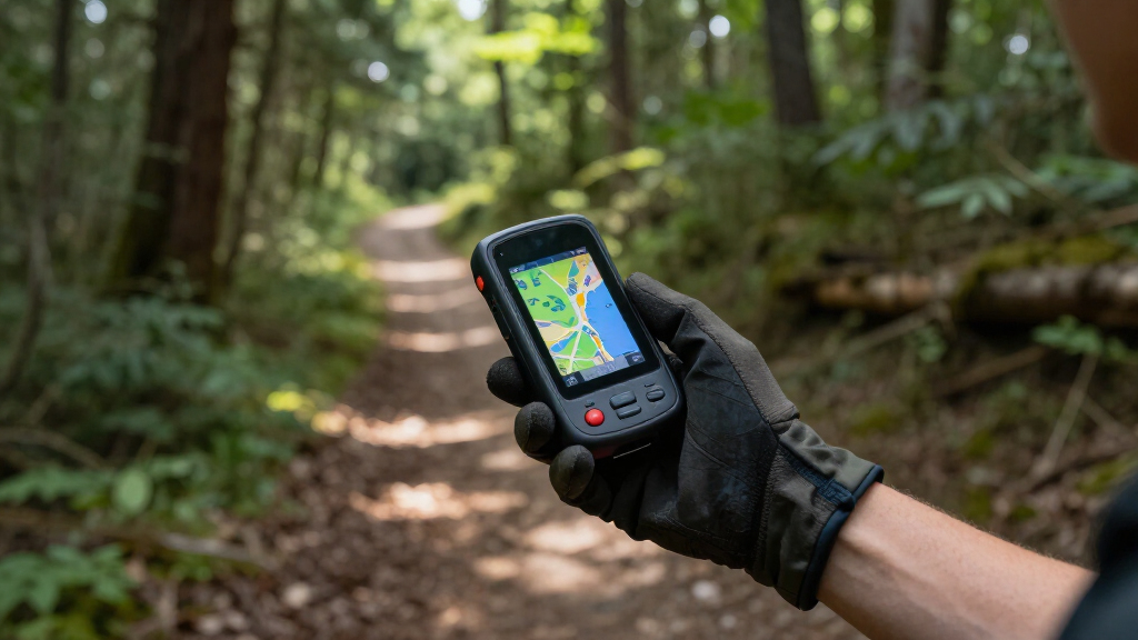
These products were evaluated based on performance, build quality, ease of use, battery life, and feature set. We prioritized devices that excel in outdoor durability and accurate navigation, especially in challenging conditions. The ranking also considers user interface clarity, availability of detailed maps, and value for the price. Models with specialized features for specific activities, such as marine navigation or multi-GNSS support, were rated higher for those use cases. Our goal was to identify options that balance functionality with reliability, matching different outdoor pursuits and budgets.| handheld gps unit | Water Resistance |
|---|---|
| Garmin eTrex SE GPS Handheld N | IPX7 |
| Garmin GPS 73 | Yes |
| Garmin Montana 710 GPS Handhel | IPX7 |
| Garmin GPSMAP 79sc Marine Hand | Water-resistant and floats |
| Garmin eTrex 32x Rugged Handhe | — |
| Garmin GPSMAP 65 Handheld GPS | — |
| Garmin GPSMAP 65s Handheld GPS | — |
| Garmin eTrex 22x Handheld GPS | — |
| Handheld GPS for Hiking | IP66 |
| Garmin eTrex 10 Worldwide Hand | — |
Factors to Consider When Choosing Handheld Gps Units
Choosing the right handheld GPS unit involves balancing several factors to match your specific outdoor activities and environment. Beyond just price, consider how ruggedness, mapping detail, and battery life impact usability. Understanding these factors helps avoid common pitfalls, such as buying a device that lacks water resistance or doesn’t support your preferred maps. Think about your main activity—hiking, boating, or general use—and select features accordingly to maximize value and satisfaction.Durability and Water Resistance
Outdoor conditions can be tough, so durability and water resistance are paramount. A rugged device with an IPX rating or MIL-STD-810 certification will withstand drops, dust, and water exposure. Skipping this can lead to device failure in the field, especially during rain or accidental drops. Consider whether your activity involves water, mud, or rough terrain, and choose a model that can handle those challenges without compromising performance.
Mapping and Navigation Features
Look for devices with detailed topographic maps, preloaded data, or the ability to add custom maps. Multi-GNSS support (GPS, GLONASS, Galileo) significantly improves accuracy in challenging environments like dense forests or valleys. Be cautious of models with limited maps or those that require costly upgrades. For maritime use, water-resistant models with nautical charts are essential, while for hiking, topo maps with elevation data are more relevant.
Battery Life and Power Options
Long battery life extends your time in the field, especially on multi-day trips. Many models support replaceable batteries or USB charging, which can be a lifesaver. Beware of devices with short battery life, which may force you to carry extra power sources or limit your usage. Consider solar charging options if available, particularly for extended outdoor adventures where power outlets are unavailable.
Ease of Use and Interface
A clear, intuitive interface reduces frustration and helps you focus on your activity. Some units feature touchscreen controls, while others rely on physical buttons for durability. Check for customizable screens and straightforward menus—complicated interfaces can slow you down when you need quick navigation. Simplicity often trumps advanced but cumbersome features for most outdoor users.
Price and Value
Higher-priced units typically offer advanced features like detailed mapping, multi-band GNSS, and rugged design. However, it’s important to match your needs to the cost—if you only hike occasionally, a budget model may suffice. Investing more makes sense if you require precise navigation in challenging environments or for marine use. Look for a device that offers the best feature set within your budget, avoiding unnecessary extras that inflate the price without added benefit.
Frequently Asked Questions
Do I need a GPS unit with marine features if I only hike?
No, a marine-specific GPS unit offers features like nautical charts and water resistance that are unnecessary for hiking. For land-based activities, a device with topographic maps and multi-GNSS support will provide more relevant navigation capabilities. Choosing a model tailored to your activity ensures better usability and value, without paying extra for features you won’t use.
How important is water resistance in a handheld GPS for hiking?
Water resistance is vital if you often hike in rain-prone environments or near water sources. A device with an IPX7 or IPX8 rating can survive rain, splashes, and even brief water immersion. Without this protection, exposure to moisture can damage the device, leading to failure when you need it most. For dry or urban hikes, water resistance is less critical but still a worthwhile feature for peace of mind.
Should I prioritize a larger screen or extended battery life?
This depends on your activity style. A larger, sunlight-readable screen makes map reading easier on the trail but may drain batteries faster. Conversely, a smaller, more energy-efficient device might last longer but require more effort to navigate visually. Consider where you’ll be using the device most often—if visibility in bright conditions is a concern, prioritize a brighter screen. For extended trips where charging options are limited, battery life might take precedence.
Is it worth paying extra for multi-band GNSS support?
Yes, multi-band GNSS significantly improves positional accuracy, especially in challenging environments such as dense forests or deep canyons. It reduces positional drift and signal loss, providing more reliable navigation. If your activities involve complex terrains or require precise location data, investing in a device with multi-band support can be well worth the additional cost.
Can I use my smartphone instead of a handheld GPS unit?
While smartphones offer navigation apps, they generally lack the ruggedness, long battery life, and dedicated GPS features of specialized handheld units. Outdoor GPS devices are built to withstand harsh conditions, provide better signal stability, and often include preloaded topographic or nautical maps. For serious outdoor use, dedicated GPS units tend to be more reliable and durable, making them a better choice for extended or challenging adventures.
Conclusion
For most users, the Garmin eTrex 32x offers a balanced combination of features, durability, and affordability, making it ideal for general outdoor explorers. Those who prioritize marine or water-based activities should consider the Garmin GPSMAP 79sc, which excels in coastal navigation. Beginners or casual hikers will find the Garmin eTrex 10 sufficient, while serious adventurers needing advanced accuracy and ruggedness may prefer models like the Garmin Montana 710 or GPSMAP 65s. Ultimately, your choice should reflect your activity, environment, and budget—matching features to your specific outdoor pursuits will ensure you get the best value and performance.
As an affiliate, we earn on qualifying purchases.Flea & tick season Picks
flea and tick prevention