
Space-based imaging helps you monitor crops, soil moisture, and pest infestations, allowing for better farming decisions. It improves weather forecasts by tracking storms, predicting rainfall, and monitoring climate changes with high accuracy. For security, it detects unauthorized activities and supports quick responses, monitoring borders and critical infrastructure. By ensuring precise, reliable data, satellite calibration maintains trustworthiness over time. Keep exploring how these advanced techniques can further enhance your understanding and applications.
Key Takeaways
- Satellite calibration ensures accurate, consistent imaging vital for monitoring crop health, soil moisture, and pest infestations in agriculture.
- Enhanced calibration improves weather prediction by providing precise data on storms, rainfall, and climate change indicators.
- Reliable space-based imagery supports security operations by detecting unauthorized activities and monitoring critical infrastructure.
- Regular calibration prevents data drift, maintaining long-term data integrity for climate trend analysis and environmental monitoring.
- High-quality imagery enables rapid response to security threats and supports decision-making in disaster management and border control.

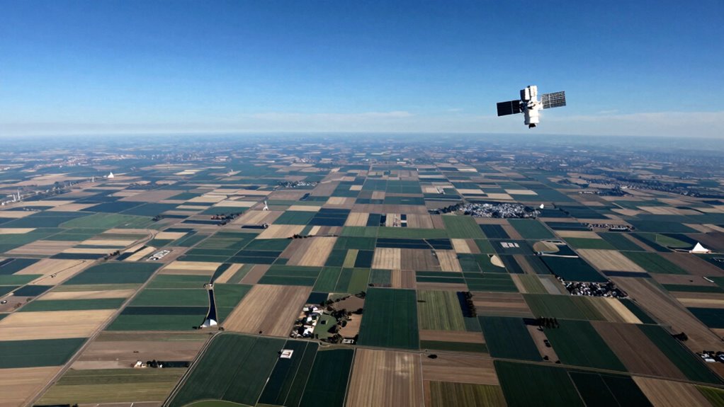
Have you ever wondered how satellite images are transforming agriculture, weather forecasting, and security? It’s all about the incredible technology working behind the scenes to deliver detailed, reliable data from space. One key aspect is satellite calibration, which guarantees that the images and measurements you see are accurate and consistent over time. Without proper calibration, the data collected could drift or contain errors, leading to flawed analysis. Satellite calibration involves adjusting sensors and instruments so they measure what they’re supposed to, maintaining data accuracy across different satellites and over extended periods. This process guarantees that the images used for farming decisions, weather predictions, or security operations are precise, trustworthy, and comparable. When satellites are well-calibrated, you can rely on the data to assess crop health, monitor weather patterns, or detect security threats with confidence. Accurate data is essential because even small inaccuracies can cause significant issues—like misjudging drought severity or missing critical security alerts. By prioritizing satellite calibration, space imaging providers uphold high standards of data integrity, which directly benefits your ability to make informed decisions.
In agriculture, this means you get clearer insights into crop conditions, soil moisture levels, and pest infestations. Farmers and agronomists use these images to optimize irrigation, fertilization, and harvest timing, ultimately increasing yields and reducing waste. Weather forecasting also benefits immensely from space imaging. Satellite data helps meteorologists track storms, predict rainfall, and monitor changing climate conditions with higher precision. When calibration is spot-on, weather models become more reliable, giving you more accurate forecasts that can help you plan your day or prepare for severe weather events. Additionally, advancements in space-based imaging technology continue to expand the scope of real-time data collection, making forecasts even more precise. Regular calibration updates are crucial for maintaining the accuracy of long-term climate data, ensuring that trends are correctly identified and analyzed. Proper calibration also helps prevent data drift, which can compromise the consistency of measurements over time. Furthermore, the integration of advanced calibration techniques enhances the overall reliability of satellite data, supporting critical decision-making processes. Security applications rely heavily on satellite imagery to monitor borders, urban areas, and critical infrastructure. Precise, calibrated images enable security agencies to detect unauthorized activities, track movements, or identify potential threats quickly. With high data accuracy, responses become faster and more effective, reducing risks and safeguarding populations. Proper calibration of satellites also plays a crucial role in maintaining data integrity, ensuring consistent and reliable information over time.

Sound Level Calibrator,Decibel Meter Calibration for Noise Measurement Reader,Output Sound Level 94dB & 114dB output levels for 1 inch and 1/2 inch Microphones
High Precision Output Levels: Enjoy the flexibility of two output levels – 94dB and 114dB – to cater…
As an affiliate, we earn on qualifying purchases.
As an affiliate, we earn on qualifying purchases.
Frequently Asked Questions
How Accurate Are Satellite Images for Detecting Small-Scale Farm Issues?
Satellite images can be quite accurate for detecting small-scale farm issues, but they do have resolution limitations. High-resolution satellites help you see finer details, though some issues may still be hard to detect. To guarantee accuracy, ground truth validation is essential; it confirms what satellite data shows. Combining satellite imagery with on-the-ground checks allows you to get a more precise understanding of farm conditions, making your decisions more effective.
Can Space Imaging Predict Extreme Weather Events With High Reliability?
Yes, space imaging can predict extreme weather events with high reliability. You depend on advanced climate modeling that integrates satellite data, which helps forecast severe conditions like storms or droughts. Continuous satellite calibration guarantees the accuracy of these images, making predictions more precise. By analyzing real-time data from space, you improve early warning systems, giving communities more time to prepare for extreme weather, ultimately enhancing safety and resilience.
What Privacy Concerns Arise From Using Satellite Data for Security Purposes?
You might think satellite data for security is foolproof, but privacy violations and data misuse are real concerns. Many believe that increased surveillance could infringe on individual privacy rights, leading to unwarranted monitoring. While satellite imaging enhances security, it also risks exposing personal activities without consent. You should stay aware of these privacy issues, advocating for clear regulations that prevent data misuse and protect your rights from unwarranted surveillance.
How Often Are Satellite Images Updated for Real-Time Farming Applications?
Satellite images for farming are typically updated daily or weekly, depending on the satellite’s imaging frequency and resolution. High-resolution satellites, with detailed imagery, might update every few days, while lower-resolution ones could take longer. This frequent imaging helps you monitor crop health, soil moisture, and growth patterns in near real-time, enabling you to make informed decisions quickly. The balance between satellite resolution and imaging frequency is key to effective farming management.
Are There International Regulations Governing the Use of Space-Based Imaging?
Like the whispers of treaties shaping our skies, international regulations do govern space-based imaging. You must navigate international treaties that set boundaries, guaranteeing data sovereignty and privacy are respected across borders. These agreements aim to prevent misuse and promote cooperation, much like guardians of celestial secrets. While regulations exist, they’re evolving, so you should stay informed to ensure your use of satellite imagery aligns with global standards and respects national sovereignty.

DJI P4 Multispectral Agriculture Drone, 3-Axis Stabilized Camera, RGB + 5 Multispectral Sensors, RTK Module, 27-Min Flight Time, 4.4-Mile Range
MULTISPECTRAL IMAGING: Advanced 6-camera array system featuring RGB camera for visible light plus 5 specialized cameras capturing multiple…
As an affiliate, we earn on qualifying purchases.
As an affiliate, we earn on qualifying purchases.
Conclusion
As you look up at the sky, it’s no coincidence that space-based imaging plays a crucial role in your daily life. From helping farmers grow better crops, predicting weather patterns, to keeping security tight, these images connect the dots in ways you might not realize. By understanding how this technology works, you’re reminded that even in the vast universe, small innovations can have a big impact on your world.
Nooelec GOES Weather Satellite RTL-SDR Bundle – Includes NESDR SMArTee XTR Software Defined Radio, & Everything Else Needed to Receive LRIT, HRIT & HRPT Satellite Weather Images Directly from Space!
This bundle will allow you to receive detailed, high-resolution, near real-time images from orbiting weather satellites. With as…
As an affiliate, we earn on qualifying purchases.
As an affiliate, we earn on qualifying purchases.
![[300°Pan 90°Tilt+Human Tracking] Hiseeu 4K PoE PTZ Camera System,NVR Security Camera System w/6Pcs 5MP Wired Security Camera Outdoor&Indoor,2-Way Audio,Waterproof,7/24 Record for Home Surveillance](https://m.media-amazon.com/images/I/41tu7EQqkVL._SL500_.jpg)
[300°Pan 90°Tilt+Human Tracking] Hiseeu 4K PoE PTZ Camera System,NVR Security Camera System w/6Pcs 5MP Wired Security Camera Outdoor&Indoor,2-Way Audio,Waterproof,7/24 Record for Home Surveillance
【300 Degree Pan /90 Degree Tilt & Auto Human Tracking】 Panl 300 Degree Tilt 90 Degree Captures every…
As an affiliate, we earn on qualifying purchases.
As an affiliate, we earn on qualifying purchases.